- Region
- Águilas
- Alhama de Murcia
- Jumilla
- Lorca
- Los Alcázares
- Mazarrón
- San Javier
-
ALL AREAS & TOWNS
- AREAS
- SOUTH WEST
- MAR MENOR
- MURCIA CITY & CENTRAL
- NORTH & NORTH WEST
- TOWNS
- Abanilla
- Abarán
- Aguilas
- Alamillo
- Alcantarilla
- Aledo
- Alhama de Murcia
- Archena
- Balsicas
- Blanca
- Bolnuevo
- Bullas
- Cañadas del Romero
- Cabo de Palos
- Calasparra
- Camping Bolnuevo
- Campo De Ricote
- Camposol
- Canada De La Lena
- Caravaca de la Cruz
- Cartagena
- Cehegin
- Ceuti
- Cieza
- Condado de Alhama
- Corvera
- Costa Cálida
- Cuevas De Almanzora
- Cuevas de Reyllo
- El Carmoli
- El Mojon
- El Molino (Puerto Lumbreras)
- El Pareton / Cantareros
- El Raso
- El Valle Golf Resort
- Fortuna
- Fuente Alamo
- Hacienda del Alamo Golf Resort
- Hacienda Riquelme Golf Resort
- Isla Plana
- Islas Menores & Mar de Cristal
- Jumilla
- La Azohia
- La Charca
- La Manga Club
- La Manga del Mar Menor
- La Pinilla
- La Puebla
- La Torre
- La Torre Golf Resort
- La Unión
- Las Palas
- Las Ramblas
- Las Ramblas Golf
- Las Torres de Cotillas
- Leiva
- Librilla
- Lo Pagan
- Lo Santiago
- Lorca
- Lorquí
- Los Alcázares
- Los Balcones
- Los Belones
- Los Canovas
- Los Nietos
- Los Perez (Tallante)
- Los Urrutias
- Los Ventorrillos
- Mar De Cristal
- Mar Menor
- Mar Menor Golf Resort
- Mazarrón
- Mazarrón Country Club
- Molina de Segura
- Moratalla
- Mula
- Murcia City
- Murcia Property
- Pareton
- Peraleja Golf Resort
- Perin
- Pilar de la Horadada
- Pinar de Campoverde
- Pinoso
- Playa Honda
- Playa Honda / Playa Paraíso
- Pliego
- Portmán
- Pozo Estrecho
- Puerto de Mazarrón
- Puerto Lumbreras
- Puntas De Calnegre
- Region of Murcia
- Ricote
- Roda Golf Resort
- Roldan
- Roldan and Lo Ferro
- San Javier
- San Pedro del Pinatar
- Santiago de la Ribera
- Sierra Espuña
- Sucina
- Tallante
- Terrazas de la Torre Golf Resort
- Torre Pacheco
- Totana
- What's On Weekly Bulletin
- Yecla


- EDITIONS:
 Spanish News Today
 Alicante Today
 Andalucia Today
article_detail
The Romans in Begastri.
The Romans created a substantial settlement at Begastri.
 Introduction to Begastri, Click Begastri Cehegin
For part 1 of the History of Begastri, Click The Iberians in Begastri
Part 2 The Romans in Begastri
Part 3 The Visigoths in Begastri
Part 4 The Moors in Begastri
During the 2nd and 3rd centuries BC, Rome was locked in a power struggle to control the Mediterranean shipping and trading routes with the Carthaginians, based in Carthage on the African coast.
This struggle lead to two sets of wars, the Punic wars, the first of which took place between 264 and 241 BC and the Second Punic wars between 218 and 202BC which gave the Romans control of the Mediterranean. After the first Punic wars, the Carthaginians were driven further away from the main Mediterranean basin, forming new colonies on what is now Spanish soil, and amongst the settlements was the Iberian colony of Mastia, (now Cartagena) which was occupied by the Barca clan in 227BC.
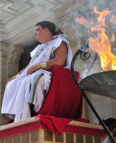
 One member of this powerful family was Hannibal, who achieved notoriety after breaching a treaty with the Romans by attacking the Roman settlement at Sagunto, before setting off across the Alps on his infamous journey with his armies and elephants to attack Rome directly.
His absence left Cartagena vulnerable,and in 209 BC, the Roman commander Publius Cornelius Scipio took advantage of his absence, carrying out a surprise attack to take the settlement, a move which initiated the steady Romanisation of this whole region.
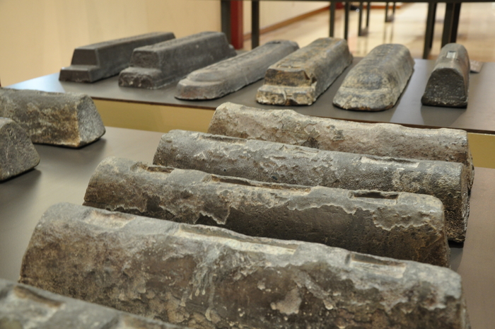
The region was rich in natural resources, mines in the Sierra Minera yielding rich deposits of silver, Alum and lead, the coinage minted from the deposits in these mines paying the armies of Rome throughout the remaining years of the Punic Wars. At one point , 30,000 slaves worked here extracting and smelting the minerals, before they were shipped off to Rome.
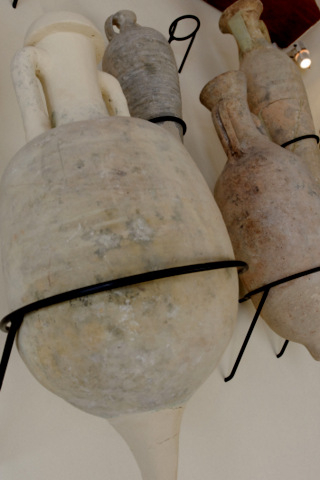
 Esparto grass, which grew wild across the hillsides, was a valuable commodity, treated and woven to make strong ropes, shoes, baskets and all types of household, agricultural and military uses. The lands yielded olive oil and grain, shipped to feed the city of Rome and the cities within the Roman Empire, along with potent fish sauces and salted fish products, made along the coast at Mazarrón, Águilas and in the Mar Menor area. Marble and limestone were mined from the north-west and transported overland to build the city of Cartagena. This rich area was exploited, but developed, the natives taught how to increase their yields, how to work the land, using techniques practised by the Romans, and gradually the native population became indiscernible from the invaders, agricultural villas dotted throughout the landscape of the region, food factories for the Roman Empire. At this point, Rome was a vast metropolis with a million inhabitants and relied on agricultural villas throughout the Empire to feed its citizens, and remains of ceramic transportation amphorae found in the centre of Rome show that spanish olive oil was part of the diet of Rome 2000 years ago.
 The establishment of the Roman Empire from 31BC, represented the definitive implantation of the pax romana in the peninsular. In 29 BC. The Emperor Augustus divided his Spanish territories into three parts, Bética, the capital of which was Córduba (or Córdoba), Lusitania, which was ruled from modern-day Mérida, and Tarraconensis, the capital of which was “Tarraco”, now Tarragona. The Region of Murcia was included within the territory of Tarraconensis, which was a vast area stretching all the way from Finisterre in the north-west of Spain to Cabo de Palos in the south-east, and included the whole of the north-west, the Cantabrian coast, the valley of the Ebro, the central plateaux and the eastern coastline.
 The importance of Carthago Nova (Cartagena) as a port for commerce lead to the creation of a communications network which criss-crossed the region, utilising existing prehistoric trading routes and linking the north-west with other cities throughout southern Spain. Although the roads leading into the north-west of Murcia were relatively small, the area was also serviced by rivers, the most important being the Segura (known as the Thader by the Romans) and the Río Quipar.
Begastri, dominated strategic crossroads, the camino del Escobar and the old cattle herding route of the camino real de Granada interlinking at this point, watching over the route which came from the Segura Valley of Murcia to the Alto Quípar connecting the interior to Andalucia, Jaén, Granada and Albacete from its hilltop location.
During the period of Roman occupation Begastri became an important population nucleus, an estimated population of 13,000 people living, both in and around the settlement, roughly equivalent to the modern population of Cehegín. Farming villas would have surrounded the 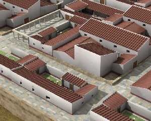 urban nucleus, constant discoveries of Roman remains in the field surrounding the hilltop testament to extensive settlement.
During the first century Begastri became a substantial Roman town, with characteristic buildings of the era, including temples and public buildings, built around the natural contours of the hillside. At this point the town lacked substantial defensive walls as the population had little fear of invasion due to the overwhelming strength of the Roman army and occupation . As the urban construction expanded and consolidated, the original defensive walls which would have existed during the Iberian era were demolished and to date no remains have been found of that original structure.
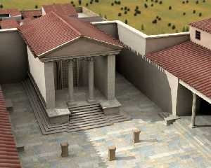 Given the size of the settlement, its quite likely that there would have been a forum, and theatre, temples and baths on site, but as only an estimated 5% of the total surface area has been excavated to date, much of the infrastructure is still to be discovered. There is certainly an indication that there may be a substantial Roman circus in the ground at the foot of the hill, but much of the structure of the hill was demolished during the construction of the railway line, although the re-use of various pieces of finished stone, both within the later Visigoth structures and in the construction of the town of Cehegín itself centuries later point to their existence. The town has a sophisticated water supply system, water brought into the town via an aquaduct directly into storage cisterns, with sewers and water systems installed throughout the town.
The question of whether Begastri had a forum, is one which tantalises archaeologists, although there is evidence that there was an altar dedicated to Jupiter, a feature commonly associated with the presence of a forum. This is the most important meeting place in any Roman town with a portico which expanded the full length of the construction, giving a central open plaza where meetings and markets took place and where the most important buildings within the town, were usually centred. Investigations are still underway to definitively locate where this would have stood.
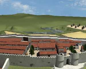 The area enjoyed uninterrupted peace until the latter part of the third century when the Roman Empire entered a time of instability, a time known as the crisis of the third century. Between 235 and 284, 25 different emperors ruled, and the engorged Roman Empire struggled to retain control of its vast territories.
Between 284 and 305 the Emperor Diocletian regained control and broke the Empire in two, creating the Eastern and Western Roman Empires, sub dividing the Spanish peninsula into five provinces during 293 AD; these were Gallaecia (capital city “Lucus”, or Lugo), Tarraconensis (capital city “Tarraco” or Tarragona), Lusitania (capital city “Emérita Augusta” or Mérida), Bética (capital city “Híspalis” or Sevilla) and Cartaginensis (capital city “Carthago Nova” or Cartagena).
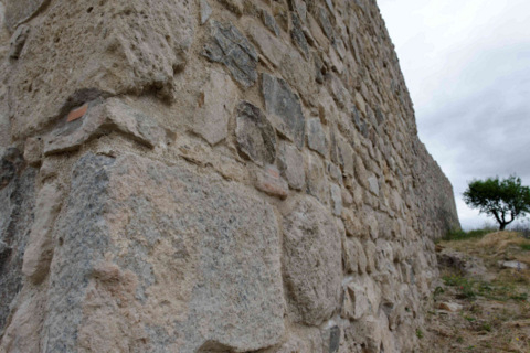 Throughout the 3rd and into the 4th century Germanic and Franco tribes began to cause problems for the empire, and life became more dangerous for residents in Begastri as news reached the town that murderous hords were sweeping down through Europe..
Gone were the days of safety, and the townspeople began to fortify the town for the dark days ahead. The important buildings within the town were dismantled and the stone used to construct defensive walls, surrounding the town with a thick impenetrable wall. Centuries later the stone would again be re-used to build the town of Cehegín.
The space inside the town was occupied by residential dwellings, smaller houses springing up in the spaces once occupied by majestic public buildings, as more townspeople moved inside the protective walls of the town.
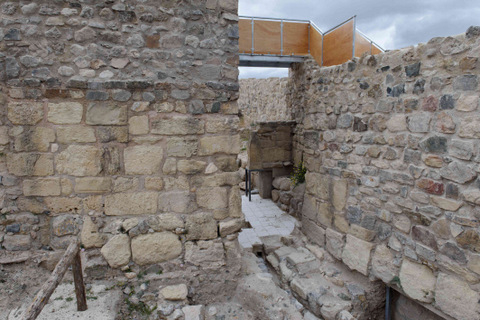 This first fortified wall of Begastri is 5 m thick and retains a height of around 5 m. Its quite probable that it would have had more balanced proportions and would have reached a height of between 10 and 11 m. With fortified towers, it would have presented a formidable obstacle, concreting the town as an important settlement through the turbulent years of the 4th and 5th centuries as the Roman Empire disintegrated and the Visigoths gained the former territories of the Romans.
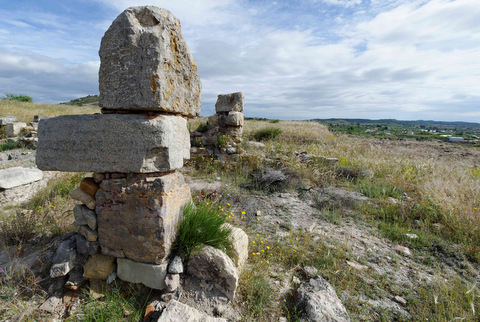
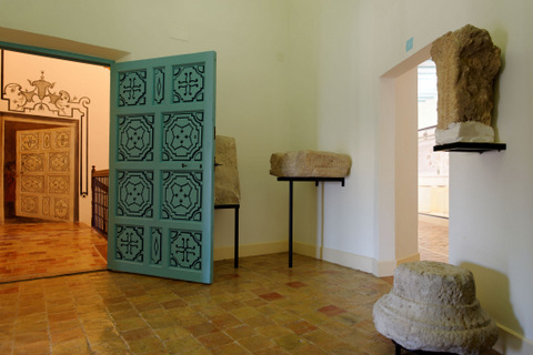
Images:Roman stonework and amphorae in the Cehegín Archaeological Museum, Lead ingots shipwrecked on the way to Rome in Cartagena Archaeological Museum, walls at the Begastri site showing the re-use of masonry from former public buildings, 3d reconstructions of the Roman forum and Roman Begastri, these 3 images used with permission. All images copyrighted.
article_detail
Contact Murcia Today: Editorial 000 000 000 /
Office 000 000 000


